
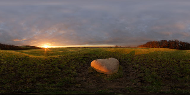
Judith Stone at sunset, East Farndon 360 VR
Click button below to view 360° VR interactive panorama
SD Standard definition suitable for users with slow internet connections or mobile devices or HD High definition suitable for users with fast internet connections
360° VR panorama of the Judith Stone, a large stone situated in a field between Lubenham, in Leicestershire, and East Farndon, in Northamptonshire. It is not known exactly how the stone got its name, but it is thought that it may have been used as a marker for the edge of land owned by the Countess Judith, the niece of William the Conqueror.
The field the Judith Stone is located in shows strong signs of Ridge and Furrow, the medieval farming method commonly used in shared fields before enclosure in the 18th century. Ridge and furrow was the result of many years of ploughing the same strip of land with a non-reversible plough.


