
Click button below to view 360° VR interactive panorama
SD Standard definition suitable for users with slow internet connections or mobile devices or HD High definition suitable for users with fast internet connections
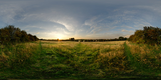
360° VR panorama of a ridge and furrow field between Market Harborough and Lubenham at sunset.
From Wikipedia:
Ridge and furrow is an archaeological pattern of ridges and troughs created by a system of ploughing used in Europe during the Middle Ages. The earliest examples date to the immediate post-Roman period and the system was used until the 17th century in some areas. Ridge and furrow topography is found in Great Britain, Ireland and elsewhere in Europe. The surviving ridges are parallel, ranging from 3 to 22 yards (3 to 20 m) apart and up to 24 in (0.61 m) tall – they were much taller when in use. Older examples are often curved.
Ridge and furrow topography was a result of ploughing with non-reversible ploughs on the same strip of land each year. It is visible on land that was ploughed in the Middle Ages, but which has not been ploughed since then. No actively ploughed ridge and furrow survives.
Click button below to view 360° VR interactive panorama
SD Standard definition suitable for users with slow internet connections or mobile devices or HD High definition suitable for users with fast internet connections
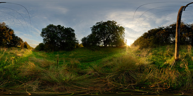
360° VR panorama of the old railway line between Lubenham and Market Harborough, Leicestershire, UK.
The line, opened in 1850, ran from Rugby to Market Harborough, but was closed under the Beeching cuts of the 1960s. Today it is mainly used by dog walkers, but it can get quite waterlogged after rain.
Click button below to view 360° VR interactive panorama
SD Standard definition suitable for users with slow internet connections or mobile devices or HD High definition suitable for users with fast internet connections
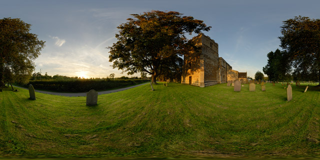
360° VR panorama of All Saints Church in Lubenham, Leicestershire, UK, at sunset. Constructed of ironstone dressed with limestone, the Church consists of a chancel, clerestoried nave, north and south aisles, a north chapel, and south porch. The West tower is castellated, and it is thought that it may once have been topped with a spire.
Click button below to view 360° VR interactive panorama
SD Standard definition suitable for users with slow internet connections or mobile devices or HD High definition suitable for users with fast internet connections
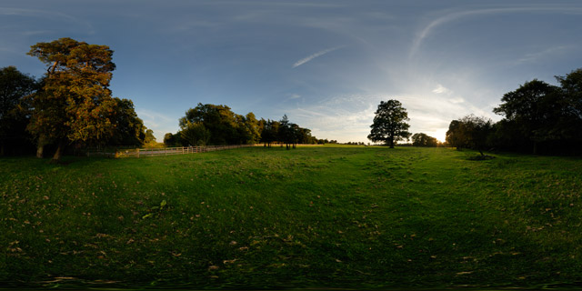
360° VR panorama of the sun setting over a field / parkland to the north of Thorpe Lubenham Hall in Lubenham, Leicestershire, UK.
Thorpe Lubenham, located to south of the river Welland that marks the southern boundary of Lubenham, was once a civil parish, but has since been absorbed into the parish of Marston Trussell. Thorpe Lubenham Hall was built around 1800, and was visited by Queen Elizabeth II and her family on a regular basis in the 1950s.

Click button below to view 360° VR interactive panorama
SD Standard definition suitable for users with slow internet connections or mobile devices or HD High definition suitable for users with fast internet connections
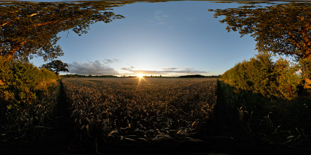
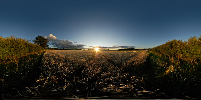
360° panorama of the sunset over a field of wheat between Market Harborough and East Farndon, Leicestershire, UK.
In the UK around 15 million tonnes of wheat is harvested annually, at a rate of approximately 8 tonnes per hectare.
From Wikipedia:
Wheat (Triticum spp.) is a grass, originally from the Fertile Crescent region of the Near East, but now cultivated worldwide. In 2007 world production of wheat was 607 million tons, making it the third most-produced cereal after maize (784 million tons) and rice (651 million tons). Globally, wheat is the leading source of vegetable protein in human food, having a higher protein content than either maize (corn) or rice, the other major cereals. In terms of total production tonnages used for food, it is currently second to rice as the main human food crop, and ahead of maize, after allowing for maize’s more extensive use in animal feeds.
Click button below to view 360° VR interactive panorama
SD Standard definition suitable for users with slow internet connections or mobile devices or HD High definition suitable for users with fast internet connections
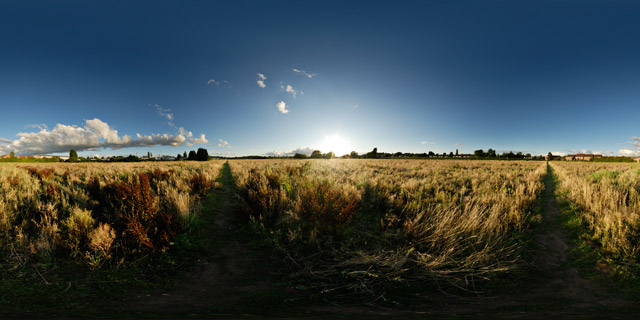
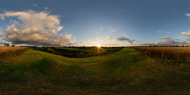
360° VR panorama of the sunset over a fallow field between Market Harborough and East Farndon in Leicestershire, UK. The field has been subject to various development proposals over the years, and is currently (as of 2010) for sale as residential development land by its owner, CJC Devlopments Co. Ltd.
Click button below to view 360° VR interactive panorama
SD Standard definition suitable for users with slow internet connections or mobile devices or HD High definition suitable for users with fast internet connections
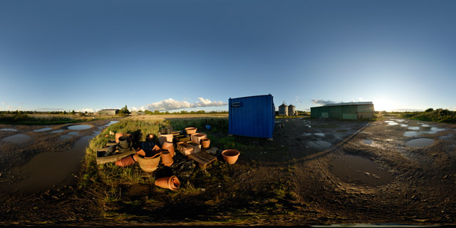
360° VR panorama of old pots and terracotta containers near a farm building behind Farndon Fields Farm shop, off Farndon road in Market Harborough, Leicestershire, UK.
Farndon Fields Farm is a 250 acre farm to the southwest of Market Harborough. They operate a popular farm shop on Farndon Road, selling their farm produce, other local produce, and also a large selection of plants, terracotta pots and compost.
Click button below to view 360° VR interactive panorama
SD Standard definition suitable for users with slow internet connections or mobile devices or HD High definition suitable for users with fast internet connections
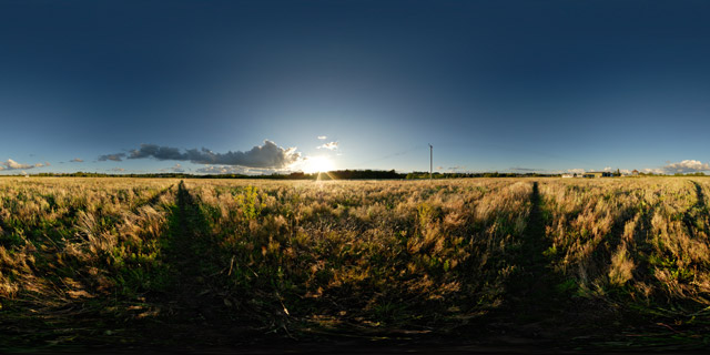
360° VR panorama of the sun setting over a field between Market Harborough and East Farndon in Leicestershire, UK. The field has been left fallow and is filled with various grasses, dock, and willowherb, amongst other plants.
Click button below to view 360° VR interactive panorama
SD Standard definition suitable for users with slow internet connections or mobile devices or HD High definition suitable for users with fast internet connections
360° VR panorama of the sunset over a field of wheat between Market Harborough and East Farndon, Leicestershire, UK.
In the UK around 15 million tonnes of wheat is harvested annually, at a rate of approximately 8 tonnes per hectare.
Click button below to view 360° VR interactive panorama
SD Standard definition suitable for users with slow internet connections or mobile devices or HD High definition suitable for users with fast internet connections
360° VR panorama of a modern wheat field that occupies an old ridge and furrow field at the top of a small valley to the east of East Farndon in Northamptonshire, England. The remains of the medieval ridge and furrow ploughing pattern can be seen in the grass humps outside the wheat field.


