Click button below to view 360° VR interactive panorama
SD Standard definition suitable for users with slow internet connections or mobile devices or HD High definition suitable for users with fast internet connections
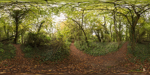
360° VR panorama along the old railway line between Market Harborough and Lubenham. The line used to be part of the Rugby and Stamford Railway, but was closed under the Beeching cuts in the 1960s. Today the line is still used, but as a footpath, with trees grown up over either side of the line.
Click button below to view 360° VR interactive panorama
SD Standard definition suitable for users with slow internet connections or mobile devices or HD High definition suitable for users with fast internet connections
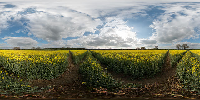
360° VR panorama on a path through a field of flowering Oilseed Rape near Marston Trussell, Northamptonshire, UK. Fields of yellow from flowering Rape plants are a common sight throughout the UK in May. The plants are grown for their oil, used in cooking and for bio-diesel. They also improve the soil quality for other crops, and are often used as a break crop.
Click button below to view 360° VR interactive panorama
SD Standard definition suitable for users with slow internet connections or mobile devices or HD High definition suitable for users with fast internet connections
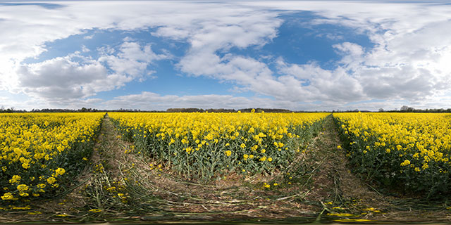
360° VR panorama on a path through a field of flowering Oilseed Rape near Marston Trussell, Northamptonshire, UK. Fields of yellow from flowering Rape plants are a common sight throughout the UK in May. The plants are grown for their oil, used in cooking and for bio-diesel. They also improve the soil quality for other crops, and are often used as a break crop.
Click button below to view 360° VR interactive panorama
SD Standard definition suitable for users with slow internet connections or mobile devices or HD High definition suitable for users with fast internet connections
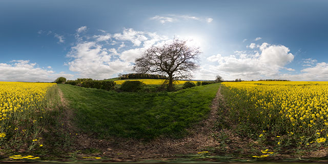
360° VR panorama on the edge of a field of flowering Oilseed Rape near East Farndon, Northamptonshire, UK. Fields of yellow from flowering Rape plants are a common sight throughout the UK in May. The plants are grown for their oil, used in cooking and for bio-diesel. They also improve the soil quality for other crops, and are often used as a break crop.
Click button below to view 360° VR interactive panorama
SD Standard definition suitable for users with slow internet connections or mobile devices or HD High definition suitable for users with fast internet connections
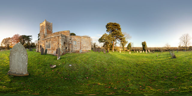
360° VR panorama in the grounds of St Nicholas Church, Marston Trussell. The current building dates from the 13th century, though it is believed there has been a church on this site from Roman times. The church is constructed from sandstone with a lead roof. The tower was built around 1525 and reaches 71 feet in height.
Click button below to view 360° VR interactive panorama
SD Standard definition suitable for users with slow internet connections or mobile devices or HD High definition suitable for users with fast internet connections
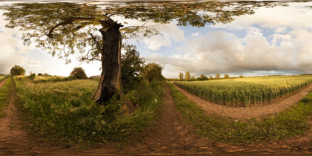
360° VR panorama of a damaged, but still alive tree growing by a field of green wheat near East Farndon, Northamptonshire, England.
Click button below to view 360° VR interactive panorama
SD Standard definition suitable for users with slow internet connections or mobile devices or HD High definition suitable for users with fast internet connections
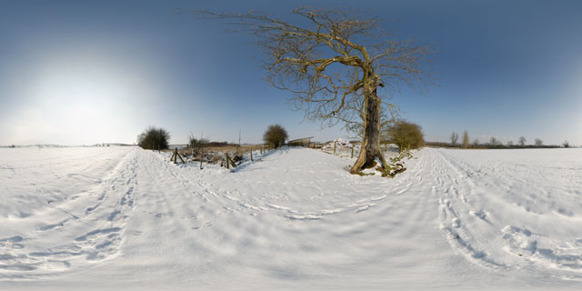
360° VR panorama of tracks through the snow past a hollow tree, between the villages of Lubenham and East Farndon, England. As well as the tracks left by walkers, there are lots of rabbits tracks left in the snow.
Beyond the dead tree there is a snow covered manure heap, and a farm building.
Click button below to view 360° VR interactive panorama
SD Standard definition suitable for users with slow internet connections or mobile devices or HD High definition suitable for users with fast internet connections
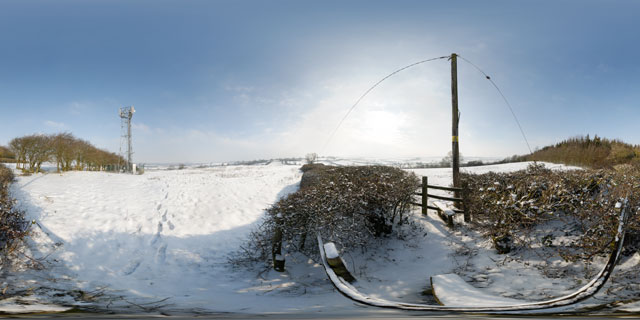
360° VR panorama of the stile between two snow covered fields at the top of a hill to the north-west of East Farndon, Northamptonshire, England. Nearby is a communications mast.
Click button below to view 360° VR interactive panorama
SD Standard definition suitable for users with slow internet connections or mobile devices or HD High definition suitable for users with fast internet connections
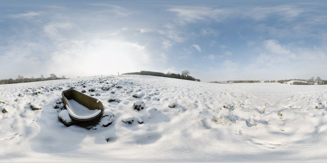
360° VR panorama of an old rusty bathtub in a snow covered field between Lubenham and East Farndon, Northamptonshire, England. The tub is probably usually used as a cattle trough. Rabbit tracks can be seen nearby in the snow.
Click button below to view 360° VR interactive panorama
SD Standard definition suitable for users with slow internet connections or mobile devices or HD High definition suitable for users with fast internet connections
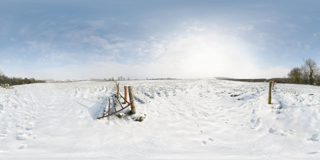
360° VR panorama of a gateway between two fields located between Lubenham and East Farndon, Northamptonshire, England. The fields are usually used as cattle pasture, though the cattle had presumably been brought into barns at the time this photo was taken due to the cold weather.
Footprints of walkers and rabbits can be seen in the snow.


