Click button below to view 360° VR interactive panorama
SD Standard definition suitable for users with slow internet connections or mobile devices or HD High definition suitable for users with fast internet connections
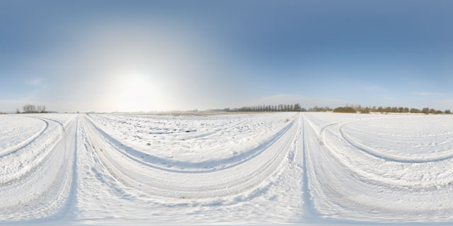
360° VR panorama of Farndon Road, near Lubenham, Leicestershire, after snowfall in February 2012. The back road links the villages of Lubenham and East Farndon while avoiding the town of Market Harborough.
The road is not used very heavily, and the compacted snow can make for hazardous driving. There are several tracks in the field next to the road that appear to have been caused by cars slipping off the road.
Click button below to view 360° VR interactive panorama
SD Standard definition suitable for users with slow internet connections or mobile devices or HD High definition suitable for users with fast internet connections
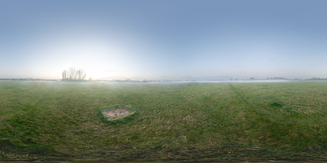
360° VR panorama of a low mist rolling across a field on a November afternoon near Marston Trussell, in Northamptonshire, England. The field is used as a hay meadow, nearby can be seen a patch of dead grass where a haybale had previously been resting for some time.
Click button below to view 360° VR interactive panorama
SD Standard definition suitable for users with slow internet connections or mobile devices or HD High definition suitable for users with fast internet connections
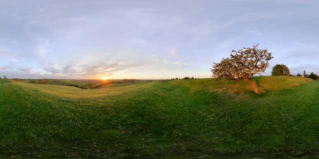
360° VR panorama of the sunset seen from the earthworks on East Farndon hill, in Northamptonshire, England. The earthworks are thought to be the remanants of an old road.
Growing out of the slope of the earthworks, an old Hawthorn tree in blossom is blown about in the strong wind. Below bullocks walk in a line across the field.
Click button below to view 360° VR interactive panorama
SD Standard definition suitable for users with slow internet connections or mobile devices or HD High definition suitable for users with fast internet connections
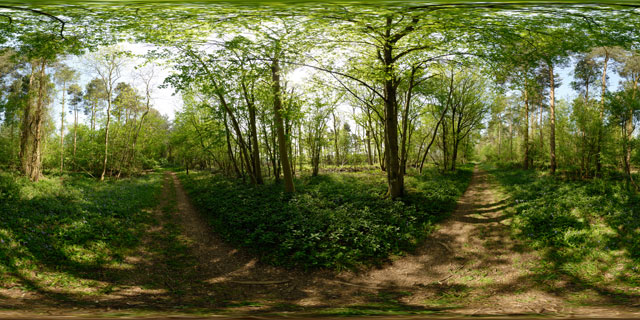
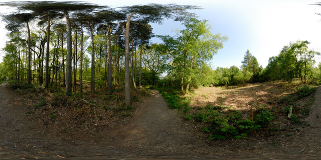
360° VR panorama of one of the paths through Wakerley Great Wood in Northamptonshire, England. The woods are part of the ancient Rockingham Forest. Part of the wood was as a deer park in the 13th century.
Today Wakerley Great Wood is a popular location for walkers and cyclists, with many trails and plenty of car parking space.
Click button below to view 360° VR interactive panorama
SD Standard definition suitable for users with slow internet connections or mobile devices or HD High definition suitable for users with fast internet connections
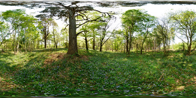
360° VR panorama of bluebells blooming in in Wakerley Great Wood, Northamptonshire, England. The woods form part of Rockingham Forest, which was created as a royal hunting forest by William the Conqueror.
Bluebells grow in deciduous woodland, flowering in Spring before the forest canopy closes, while light can still reach the forest floor.
Click button below to view 360° VR interactive panorama
SD Standard definition suitable for users with slow internet connections or mobile devices or HD High definition suitable for users with fast internet connections
360° VR panorama of part of Wakerley Great Wood where some new fern plants are growing, in Northamptonshire, UK. The woods are a popular location for walkers, cyclists, and horse riders, with a number of different trails through the woods.
Click button below to view 360° VR interactive panorama
SD Standard definition suitable for users with slow internet connections or mobile devices or HD High definition suitable for users with fast internet connections
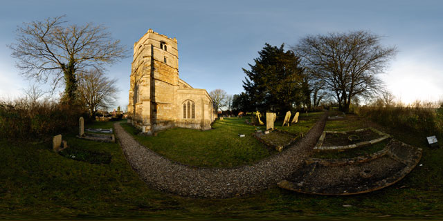
360° VR panorama of the western side of the Church of St. John the Baptist, a grade I listed church in East Farndon, Northamptonshire, England. The church is located at the southern end of East Farndon village, on top of a hill. It is not known exactly when the church was originally built, but it is thought it was probably built around 1300.
The Church has been altered several times throughout its history, it originally had a north aisle, which has since been demolished. The pinnacles at the tower corners were added in 1911 to celebrate the coronation of King George V.
Click button below to view 360° VR interactive panorama
SD Standard definition suitable for users with slow internet connections or mobile devices or HD High definition suitable for users with fast internet connections
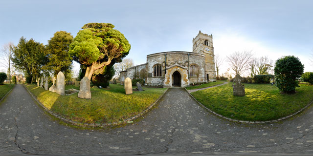
360° VR panorama of the Church of St. John the Baptist, a grade I listed church in East Farndon, Northamptonshire, England. The church is located at the southern end of East Farndon village, on top of a hill. It is not known exactly when the church was originally built, but it is thought it was probably built around 1300.
The Church has been altered several times throughout its history, it originally had a north aisle, which has since been demolished. The pinnacles at the tower corners were added in 1911 to celebrate the coronation of King George V.
Click button below to view 360° VR interactive panorama
SD Standard definition suitable for users with slow internet connections or mobile devices or HD High definition suitable for users with fast internet connections
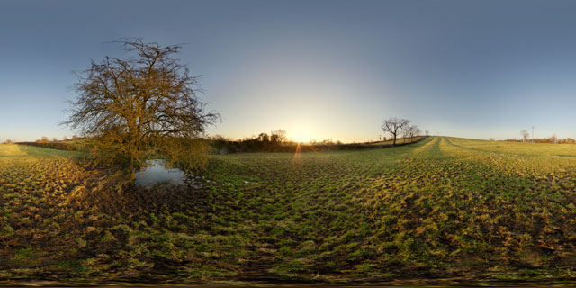
360° VR panorama of the sunset over a field near the village of East Farndon, Northamptonshire, England.
The distinctive lines of the medieval ridge and furrow farming pattern can clearly be seen on the hillside. Although ridge and furrow farming hasn’t been practised here for over two hundred years, the pattern survives in fields that have been kept as pasture since 1781 when the fields were enclosed.
Click button below to view 360° VR interactive panorama
SD Standard definition suitable for users with slow internet connections or mobile devices or HD High definition suitable for users with fast internet connections
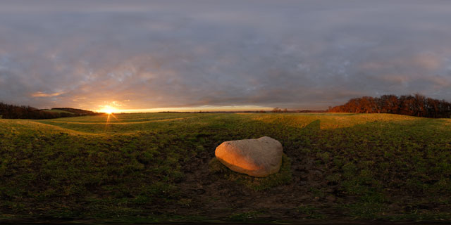
360° VR panorama of the Judith Stone, a large stone situated in a field between Lubenham, in Leicestershire, and East Farndon, in Northamptonshire. It is not known exactly how the stone got its name, but it is thought that it may have been used as a marker for the edge of land owned by the Countess Judith, the niece of William the Conqueror.
The field the Judith Stone is located in shows strong signs of Ridge and Furrow, the medieval farming method commonly used in shared fields before enclosure in the 18th century. Ridge and furrow was the result of many years of ploughing the same strip of land with a non-reversible plough.


