Click button below to view 360° VR interactive panorama
SD Standard definition suitable for users with slow internet connections or mobile devices or HD High definition suitable for users with fast internet connections
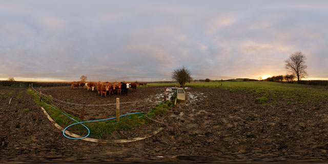
360° VR panorama of a muddy field near East Farndon, in Northamptonshire, England. A nearby group of curious bullocks wonder what someone is doing taking a panorama in a muddy field.
Click button below to view 360° VR interactive panorama
SD Standard definition suitable for users with slow internet connections or mobile devices or HD High definition suitable for users with fast internet connections
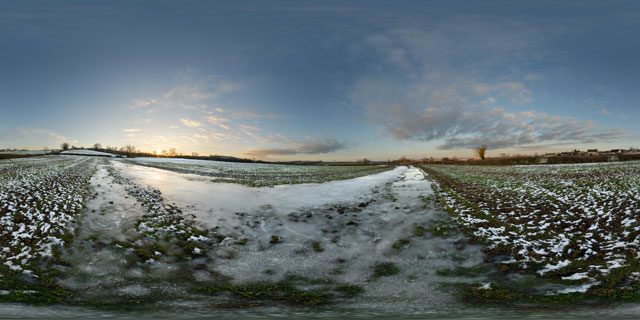
360° VR panorama of a large frozen puddle in a field near East Farndon, in Northamptonshire, England.
Click button below to view 360° VR interactive panorama
SD Standard definition suitable for users with slow internet connections or mobile devices or HD High definition suitable for users with fast internet connections
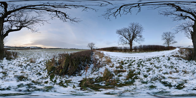
360° VR panorama of a snowy field just off Lubenham Road, near East Farndon, in Northamptonshire, England.
Many parts of the UK received heavy snowfall in late November / early December 2010, but the North Northamptonshire and south Leicestershire area got off with only a few centimetres of snow.
Click button below to view 360° VR interactive panorama
SD Standard definition suitable for users with slow internet connections or mobile devices or HD High definition suitable for users with fast internet connections
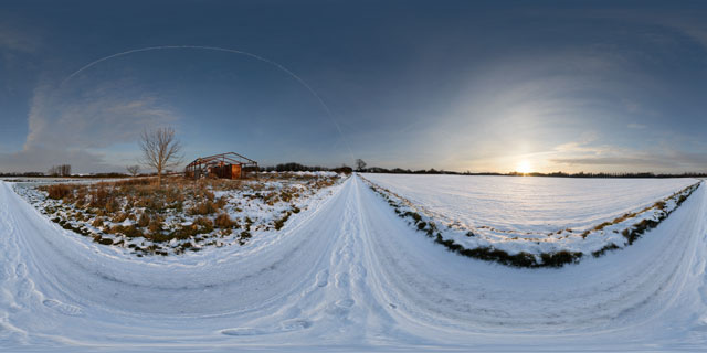
360° VR panorama of the sunset over the snow covered road and fields between Lubenham and East Farndon, around the border between Leicestershire and Northamptonshire, England.
The snow on the road had become packed down by the weight of vehicles traveling along the road, and so was extremely slippy.
Click button below to view 360° VR interactive panorama
SD Standard definition suitable for users with slow internet connections or mobile devices or HD High definition suitable for users with fast internet connections
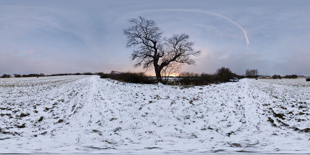
360° VR panorama of a snowy field at twilight between the Leicestershire town of Market Harborough and village of Lubenham, though technically located in Northamptonshire.
Many parts of the UK were hit by heavy snow in late November and early December 2010, though the North Northamptonshire and South Leicestershire area only received a few centimetres.
Click button below to view 360° VR interactive panorama
SD Standard definition suitable for users with slow internet connections or mobile devices or HD High definition suitable for users with fast internet connections
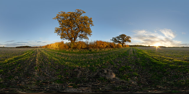
360° VR panorama of the sunset over a field just north of East Farndon, near Market Harborough, and around the border between Leicestershire and Northamptonshire, UK. The oak trees and hedge running along the edge of the field have turned yellow as the Autumn colour peaks.
Click button below to view 360° VR interactive panorama
SD Standard definition suitable for users with slow internet connections or mobile devices or HD High definition suitable for users with fast internet connections
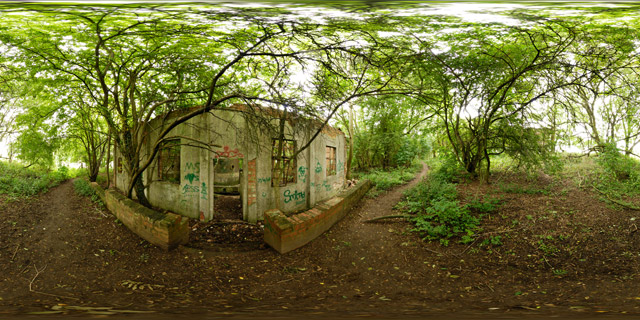
360° VR panorama of an old building in a wooded area on the northeast corner of Welford reservoir. The building has been out of use for quite some time, now being overgrown with trees and daubed with graffiti. Inside the building can be seen some large tanks.
Welford Reservoir is located near the town of Welford, and provides water to the Welford arm of the Grand Union Canal.
Click button below to view 360° VR interactive panorama
SD Standard definition suitable for users with slow internet connections or mobile devices or HD High definition suitable for users with fast internet connections
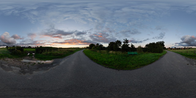
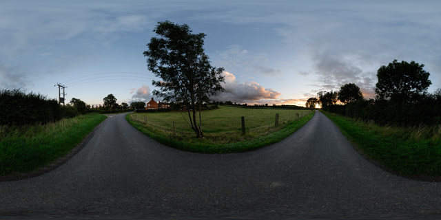
360° VR panorama of Lubenham Road in East Farndon, Northamptonshire, UK. The narrow road connects the village of East Farndon to Lubenham while bypassing the town of Market Harborough.
Click button below to view 360° VR interactive panorama
SD Standard definition suitable for users with slow internet connections or mobile devices or HD High definition suitable for users with fast internet connections
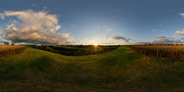
360° VR panorama of a modern wheat field that occupies an old ridge and furrow field at the top of a small valley to the east of East Farndon in Northamptonshire, England. The remains of the medieval ridge and furrow ploughing pattern can be seen in the grass humps outside the wheat field.


