Click button below to view 360° VR interactive panorama
SD Standard definition suitable for users with slow internet connections or mobile devices or HD High definition suitable for users with fast internet connections
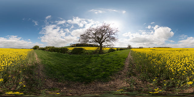
360° VR panorama on the edge of a field of flowering Oilseed Rape near East Farndon, Northamptonshire, UK. Fields of yellow from flowering Rape plants are a common sight throughout the UK in May. The plants are grown for their oil, used in cooking and for bio-diesel. They also improve the soil quality for other crops, and are often used as a break crop.
Click button below to view 360° VR interactive panorama
SD Standard definition suitable for users with slow internet connections or mobile devices or HD High definition suitable for users with fast internet connections
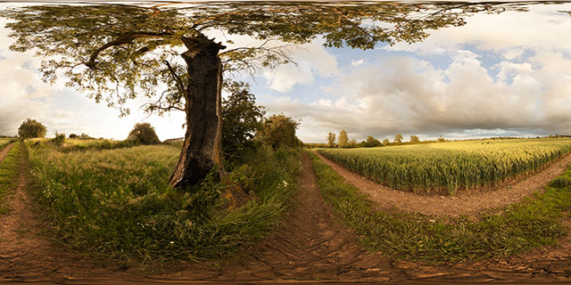
360° VR panorama of a damaged, but still alive tree growing by a field of green wheat near East Farndon, Northamptonshire, England.
Click button below to view 360° VR interactive panorama
SD Standard definition suitable for users with slow internet connections or mobile devices or HD High definition suitable for users with fast internet connections
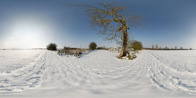
360° VR panorama of tracks through the snow past a hollow tree, between the villages of Lubenham and East Farndon, England. As well as the tracks left by walkers, there are lots of rabbits tracks left in the snow.
Beyond the dead tree there is a snow covered manure heap, and a farm building.
Click button below to view 360° VR interactive panorama
SD Standard definition suitable for users with slow internet connections or mobile devices or HD High definition suitable for users with fast internet connections
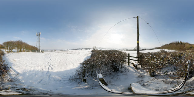
360° VR panorama of the stile between two snow covered fields at the top of a hill to the north-west of East Farndon, Northamptonshire, England. Nearby is a communications mast.
Click button below to view 360° VR interactive panorama
SD Standard definition suitable for users with slow internet connections or mobile devices or HD High definition suitable for users with fast internet connections
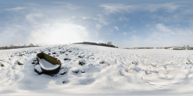
360° VR panorama of an old rusty bathtub in a snow covered field between Lubenham and East Farndon, Northamptonshire, England. The tub is probably usually used as a cattle trough. Rabbit tracks can be seen nearby in the snow.
Click button below to view 360° VR interactive panorama
SD Standard definition suitable for users with slow internet connections or mobile devices or HD High definition suitable for users with fast internet connections
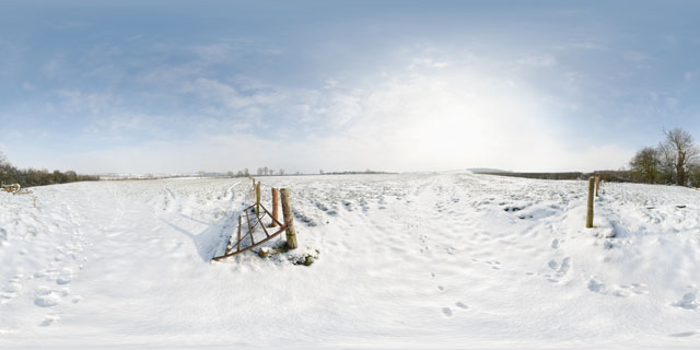
360° VR panorama of a gateway between two fields located between Lubenham and East Farndon, Northamptonshire, England. The fields are usually used as cattle pasture, though the cattle had presumably been brought into barns at the time this photo was taken due to the cold weather.
Footprints of walkers and rabbits can be seen in the snow.
Click button below to view 360° VR interactive panorama
SD Standard definition suitable for users with slow internet connections or mobile devices or HD High definition suitable for users with fast internet connections
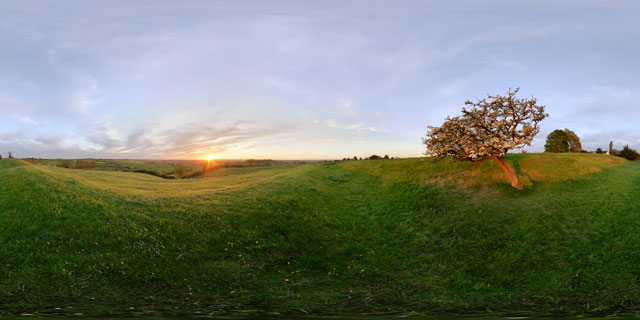
360° VR panorama of the sunset seen from the earthworks on East Farndon hill, in Northamptonshire, England. The earthworks are thought to be the remanants of an old road.
Growing out of the slope of the earthworks, an old Hawthorn tree in blossom is blown about in the strong wind. Below bullocks walk in a line across the field.
Click button below to view 360° VR interactive panorama
SD Standard definition suitable for users with slow internet connections or mobile devices or HD High definition suitable for users with fast internet connections
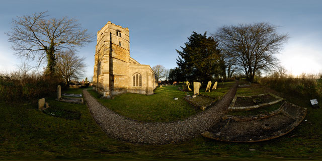
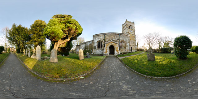
360° VR panorama of the western side of the Church of St. John the Baptist, a grade I listed church in East Farndon, Northamptonshire, England. The church is located at the southern end of East Farndon village, on top of a hill. It is not known exactly when the church was originally built, but it is thought it was probably built around 1300.
The Church has been altered several times throughout its history, it originally had a north aisle, which has since been demolished. The pinnacles at the tower corners were added in 1911 to celebrate the coronation of King George V.
Click button below to view 360° VR interactive panorama
SD Standard definition suitable for users with slow internet connections or mobile devices or HD High definition suitable for users with fast internet connections
360° VR panorama of the Church of St. John the Baptist, a grade I listed church in East Farndon, Northamptonshire, England. The church is located at the southern end of East Farndon village, on top of a hill. It is not known exactly when the church was originally built, but it is thought it was probably built around 1300.
The Church has been altered several times throughout its history, it originally had a north aisle, which has since been demolished. The pinnacles at the tower corners were added in 1911 to celebrate the coronation of King George V.
Click button below to view 360° VR interactive panorama
SD Standard definition suitable for users with slow internet connections or mobile devices or HD High definition suitable for users with fast internet connections
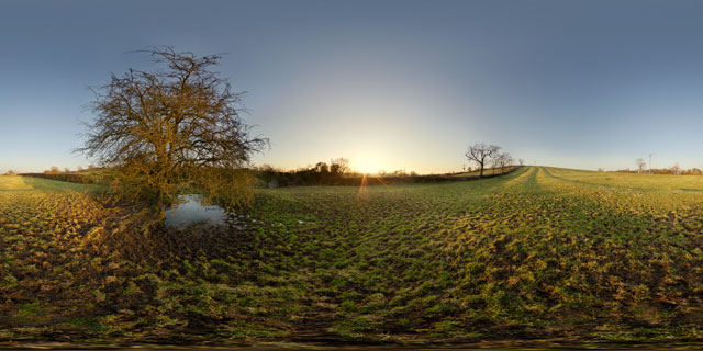
360° VR panorama of the sunset over a field near the village of East Farndon, Northamptonshire, England.
The distinctive lines of the medieval ridge and furrow farming pattern can clearly be seen on the hillside. Although ridge and furrow farming hasn’t been practised here for over two hundred years, the pattern survives in fields that have been kept as pasture since 1781 when the fields were enclosed.


