Click button below to view 360° VR interactive panorama
SD Standard definition suitable for users with slow internet connections or mobile devices or HD High definition suitable for users with fast internet connections
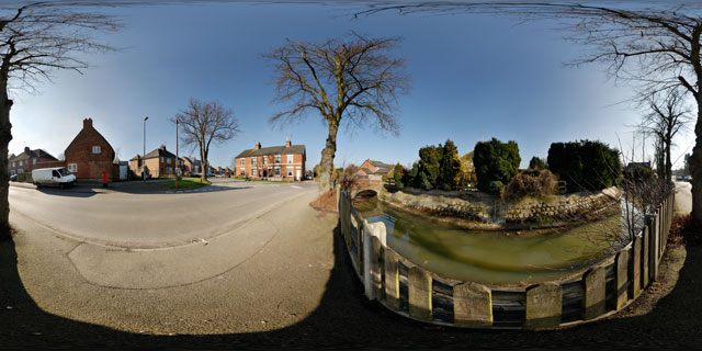
360° VR panorama of the River Jordan and Scotland Road, in Little Bowden, Leicestershire, England.
The Jordan starts to the south-west of Braybrooke village in Northamptonshire, and then flows north-west through the countryside, and on into Little Bowden in Leicestershire. It then joins the River Welland near Market Harborough Train Station, a total course of around 3-4 miles.
Little Bowden used to be part of Northamptonshire (being south of the River Welland, which has traditionally served as the boundary between Leicestershire and Northamptonshire), but was transferred to Leicestershire in the late 19th century.
Click button below to view 360° VR interactive panorama
SD Standard definition suitable for users with slow internet connections or mobile devices or HD High definition suitable for users with fast internet connections
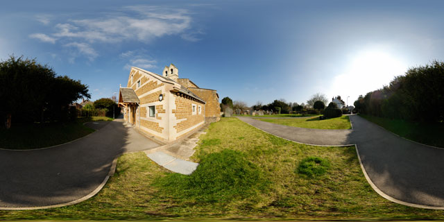
360° VR panorama of the Church of St. Nicholas in Little Bowden, Leicestershire, England. The church is a grade II listed building. It is not known when a church was originally established here, but it is thought to be around the 12th century. Certainly, by the late 14th century the Church was well established.
The south porch of St. Nicholas’ dates from the 15th century, but was restored in 1928. The Church used to be topped with a wooden belfry, but this was replaced by the current stone bellcote in 1900. At the west end of the church (shown here) is a new extension, which was completed in 2008.
Click button below to view 360° VR interactive panorama
SD Standard definition suitable for users with slow internet connections or mobile devices or HD High definition suitable for users with fast internet connections
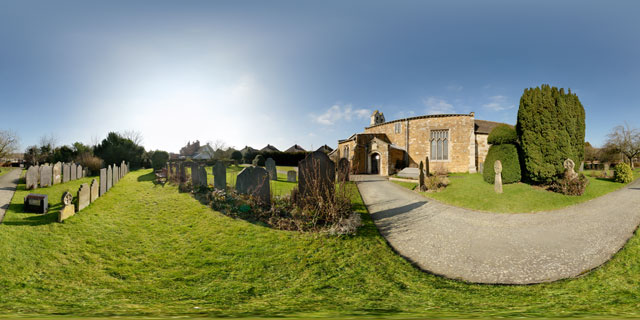
360° VR panorama of the Church of St. Nicholas in Little Bowden, Leicestershire, England. The church is a grade II listed building. It is not known when a church was originally established here, but it is thought to be around the 12th century. Certainly, by the late 14th century the Church was well established.
The nave and north aisle of St. Nicholas’ can be dated to the 13th to 14th century, while the south porch dates from the 15th century, but was restored in 1928. The Church used to be topped with a wooden belfry, but this was replaced by the current stone bellcote in 1900. At the west end of the church is a new extension, completed in 2008.
Click button below to view 360° VR interactive panorama
SD Standard definition suitable for users with slow internet connections or mobile devices or HD High definition suitable for users with fast internet connections
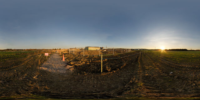
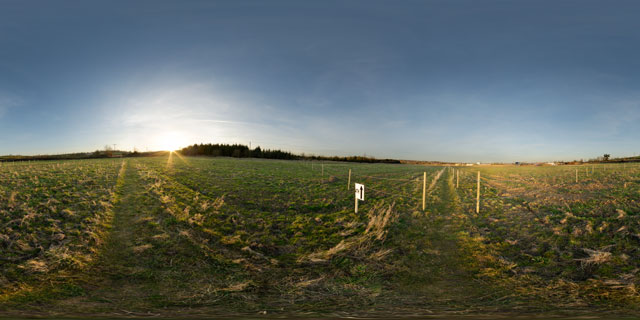
360° VR panorama of the pedestrian walkway across the building development at Farndon Fields, in Market Harborough, Leicestershire, England. As at February 2011, Farndon Fields is still in the early stages of development, with a number of homes planned to built on the site.
Click button below to view 360° VR interactive panorama
SD Standard definition suitable for users with slow internet connections or mobile devices or HD High definition suitable for users with fast internet connections
360° VR panorama of the path across Farndon Fields in Market Harborough, Leicestershire, England. Farndon Fields is currently under development, with a number of homes being built on the site.
The path in this area of Farndon Fields has been fenced off, and is clearly labelled with an ‘ATH’ sign.
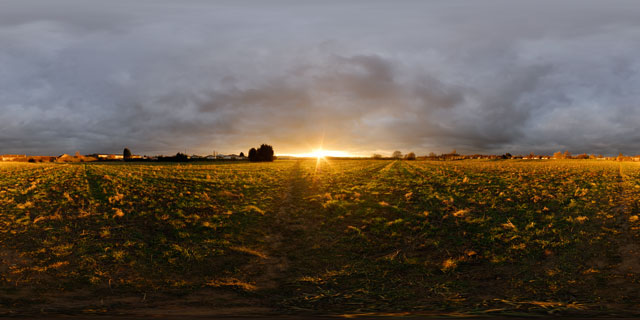
Click button below to view 360° VR interactive panorama
SD Standard definition suitable for users with slow internet connections or mobile devices or HD High definition suitable for users with fast internet connections
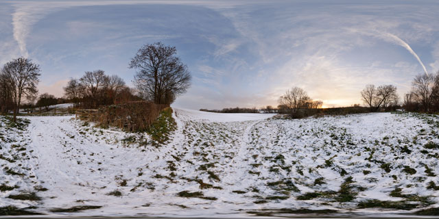
360° VR panorama of the sunset over a snowy field between Lubenham and Market Harborough in December 2010.
Much of the UK was hit with heavy snow in late November and early December 2010, though South Leicestershire / North Northamptonshire came off relatively lightly with only a few centimetres.
Click button below to view 360° VR interactive panorama
SD Standard definition suitable for users with slow internet connections or mobile devices or HD High definition suitable for users with fast internet connections
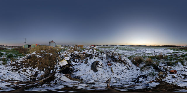
360° VR panorama of a pile of mud and rubbish at twilight on a snowy day in Farndon Fields, Market Harborough, Leicestershire, UK.
Farndon Fields is being developed for housing, and currently (November 2010) is having a sewer system installed.
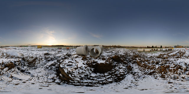
Click button below to view 360° VR interactive panorama
SD Standard definition suitable for users with slow internet connections or mobile devices or HD High definition suitable for users with fast internet connections
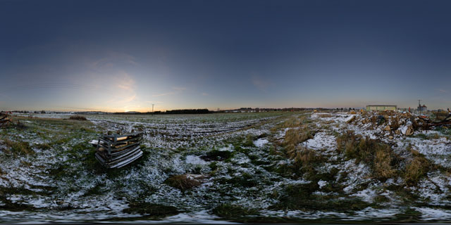
360° VR panorama of Farndon Fields at sunset on a snowy day, in Market Harborough, Leicestershire, England. Nearby rests a stack of old trolleys and a pile of rubbish and rubble.
Farndon Fields is currently (November 2010) being developed for housing by David Wilson Homes.
Click button below to view 360° VR interactive panorama
SD Standard definition suitable for users with slow internet connections or mobile devices or HD High definition suitable for users with fast internet connections
360° VR panorama of the sunset over Farndon Fields on a snowy November day in Market Harborough, Leicestershire, UK.
Farndon Fields is being developed for housing, and is currently (November 2010) having the pipes for the sewer installed.
Click button below to view 360° VR interactive panorama
SD Standard definition suitable for users with slow internet connections or mobile devices or HD High definition suitable for users with fast internet connections
360° VR panorama of the sunset over a field in Farndon Fields, Market Harborough, England. Farndon Fields is currently (November 2010) being developed for housing.


